Development of Methods and Concepts for the Processing of Geodata for Detailed 3D City Models
Einleitung
Three-dimensional virtual city models play an increasingly important role in various fields, including digital city planning, citizen engagement, disaster prevention and more. These models act as virtual twins of real cities, capturing and presenting information necessary for the intended application. A key feature of these virtual replicas is their ability to reliably represent the exact geometry and colours of their real-world counterparts. However, the process of creating these virtual city models is not without its challenges. It involves complex steps that require a lot of attention to detail. Even small mistakes in the development of the model can lead to problems that, if not handled properly, can affect the integrity of the entire project.
Methoden
To address the problem at hand, a workflow was developed, encompassing various stages like initial goal setting, selection of an acquisition method, raw data analysis, pre-processing, and surface model generation. These processes are extensive and interdependent, making them challenging to reconcile. For example, considerations during the planning phase involve among others budget constraints, obtaining permissions for aerial recording if necessary, defining the required quality and quantity of recordings and the recording technique used in the first place. Because of this complexity, the workflow includes a support system that allows the user to address or work around problems as they arise, and to avoid them in the first place wherever possible. The workflow incorporates the two main acquisition technologies, photogrammetry and lidar scanning, and can be extended to include other technologies. It can be applied in future project planning and implementation for city model creation. Furthermore, it is also versatile enough to be used in other three-dimensional modelling scenarios, allowing flexibility and customisation to meet the specific needs of each project.
Ergebnisse
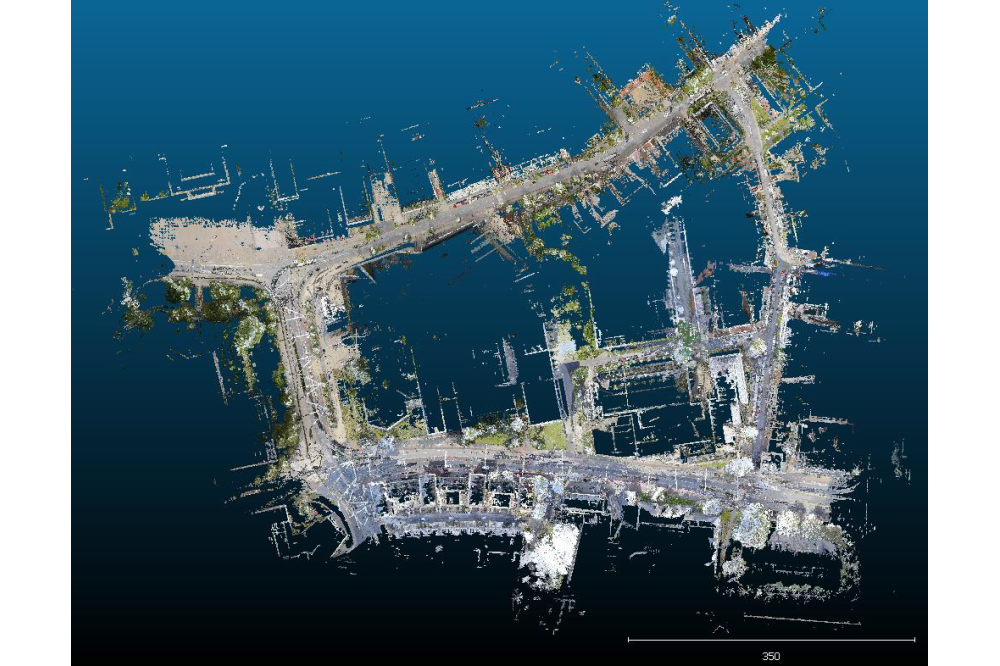
The effectiveness of the developed workflow was validated through a test project involving the creation of a three-dimensional model of a block of houses in the centre of Darmstadt. Both lidar scans and image data were used, allowing comprehensive testing of both aspects of the workflow. The Lichtenberg cluster was required for this testing. To understand why and how, it is necessary to look at one of the acquisition methods. Photogrammetry uses images where, simply put, the shooting positions of the images are determined relative to each other based on common image content, such as cars or trees. Subsequently, a position can be assigned to the pixels of the images by means of triangulation, whereby the two points of the triangle represent the two shooting positions. Repeating this process for many images results in a multitude of captured three-dimensional points in space, also known as a point cloud. Arranging the images and computing the points is a computationally and memory intensive task that takes several days, even if several powerful computing nodes of the Lichtenberg cluster are used. Analysis of the results demonstrated that the developed concept is effective and offers viable alternative solutions for real-world challenges. The generated 3D models using lidar and photogrammetry complement each other in terms of colour and geometric detail, and exhibit appropriate quality given the prevailing circumstances.
Diskussion
In summary, the developed workflow represents an advance in the creation of three-dimensional virtual city models. By overcoming the challenges and complexities involved, it opens new opportunities for digital urban planning, citizen engagement, disaster management and other fields that rely on accurate and reliable virtual replicas of real cities. Its effectiveness in creating high-quality three-dimensional models and its adaptability to different scenarios make it a valuable tool for future urban planning and implementation projects.


