Wind Field Simulation for Operation of UAS in Urban Environments
 Krüger, Louis_Wind Field Simulation for Operation of UAS in Urban Environments_1
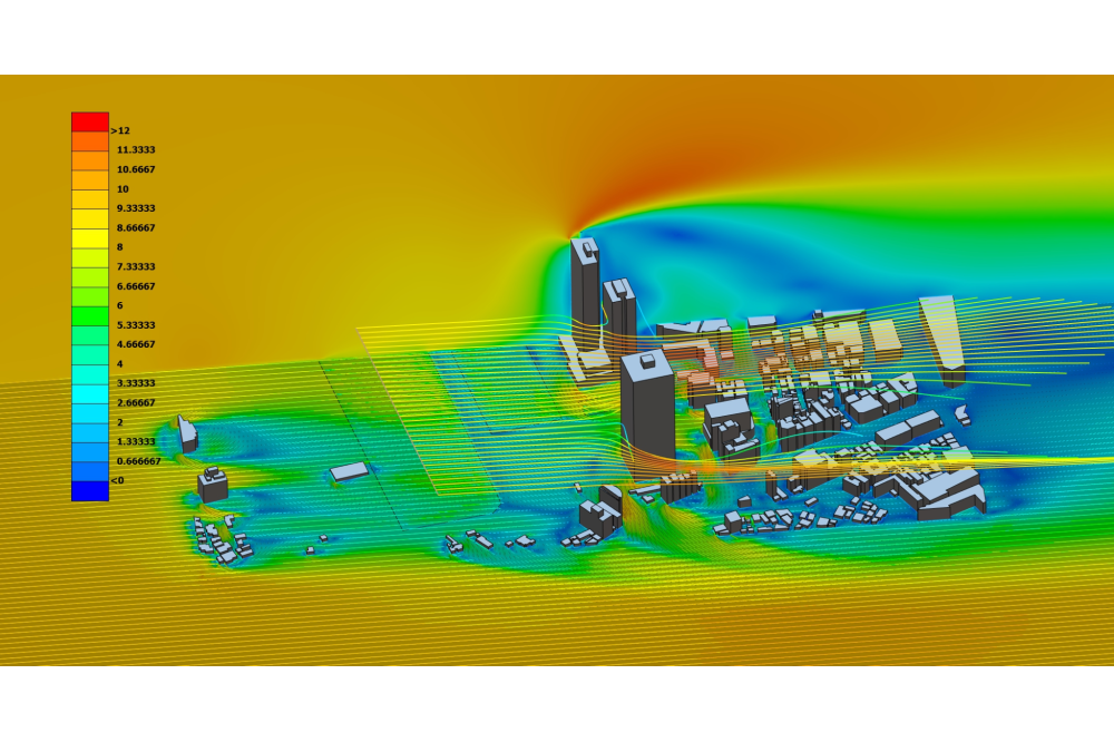
Figure 1: Three dimensional velocity field around the buildings including multiple streamlines.
Louis Krüger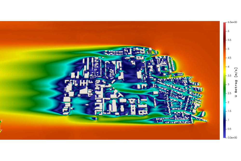 Krüger, Louis_Wind Field Simulation for Operation of UAS in Urban Environments_2
Figure 2: Velocity magnitude with east wind direction 5m above the ground.
Louis KrügerEinleitung
For the coming years, a strongly growing use of unmanned aerial vehicles (UAV) of all classes is predicted, for example in agriculture, construction or disaster control. But, in order to quantify the actual traffic volume under different scenarios, appropriate models and empirical values are currently still lacking. These are of great use in research, as they make it possible to design regulations, technical support systems and airspaces in such a way that safe and efficient regular operation of UAVs can be ensured. Therefore, one of our SESAR projects DACUS is considering, among other things, how weather influences affect the capacity of urban airspace and operations. However, detailed micro weather forecasts today are not practical for a regular computation and a day-by-day usage in operation, since the calculation effort is too large and time-constrained. Instead, we will investigate in this project proposed here if it is possible to use pre-processed wind field data to train models that refine existing meso scale weather forecasts. Thus, we use a flow simulation to calculate wind speeds in an urban environment for typical wind directions and strengths identified in an observed area. Of special interest are the complex phenomena that exist in the so-called Urban Canopy Layer (UCL) and typical flight altitudes of UAV (500 ft. AGL). As a conclusion of the project, we envision an appropriate form of data preparation and presentation that ensures subsequent use in data-based learning procedures and the estimation of airspace capacity through risk zones.
Methoden
The spine of the CFD simulations of urban environments is the geometric data. The geometric data is obtained using the Blender AddOn OpenStreetMap. This data set is of poor quality for CFD simulations. To improve the geometric quality the data produced by Blender is processed using ANSA. This leads to a watertight CAD file. After that a CFD mesh is created.
With the mesh a CFD simulation using OpenFOAM is performed. Due to the high number of volume cells (150 - 200 million) a RANS simulation using the k-⍵ SST model was performed.
Ergebnisse
The result of the project is a workflow on how to estimate velocities, pressure and turbulence properties in urban areas. This workflow consists of geometry generation, improvement, meshing, a CFD simulation and data extraction. This might be a milestone, because until now CFD simulations on urban environments have been on smaller scales, what is due to their high geometric and numeric complexity. Therefore this project handles the biggest part of an urban area that could be found while researching.
Diskussion
The result of this project was a workflow that enables a user to generate a comparable simulation of an arbitrary part of the world. Because urban areas can be characterised by high size gradients in their geometric structure, the numeric complexity is quite high. That makes it necessary to rely on simpler turbulence models like k-⍵ SST or a longer calculation time to guarantee convergence. Because of the time restriction of this project it was not able to include a full 360° circle for the wind directions and the amount of generated data is too high to be visualised in a good manner.For the aimed result both of these points are less relevant and therefore the result are very satisfactory.